

Nationwide U.S. 3D LiDAR & Matterport Scan Coverage
Digital Property Solutions
Matterport | LiDAR | Floor Plans | Drone Modeling | Site Surveys | BIM
888.680.4799
Chicago 312.825.1292
St. Louis 314.582.1750


-
Facility Management Workflows
-
IoT Device Integrations
-
IBM Maximo Integration
-
Staff Training and Emergency Plans
-
Interactive Augmented Reality
-
Remote Site Audits
-
Brand Compliance Surveys

-
Pre-Drywall 3D Visuals
-
AutoCAD Floor Plans
-
Revit and BIM Modeling
-
Site Progress Documentation
-
Insurance Documentation
-
Team Project Collaboration Solutions
-
Site Surveys & Measurements
-
TruePlan for XACTIMATE
-
3D Point Clouds
.jpg)
-
Hospitality
-
Senior Care Centers
-
Tradeshows & Showrooms
-
Schools & Universities
-
Banquets & Event Venues
-
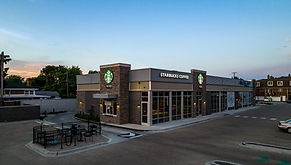
Retail
-
Fitness Centers & Country Clubs
-
Manufacturing Facilities
-
Yachts & Airplanes
-
Plus More!

-
Office, Retail and Industrial Property for Lease or Sale
-
Portfolio Digitization
-
Remote Site Selection Surveys
-
GSA Real Property Reports
-
Property Navigation Mapping

-
Residential Building Sales & Rental Portfolio Solutions
-
All-in-One Digital Dashboard for Leasing & Resident Engagement
-
3D Routine Cleaning, Maintenance & Short-Term Rental Turnover Guides
-
Virtual Remodel and Moving Quotes Made Easy
-
Rental Turnover Evidence
Why Choose View My Space?
Industries We Serve
Our Services

Nationwide LiDAR & Matterport 3D Capture
Our local travel-ready teams and national partners ensure your multi-site projects are completed swiftly and adhere to strict uniform standards.
Custom 3D Solutions, not just a Matterport link
We provide customized Digital Property Solutions that maximize the value of your Digital Twin and project deliverables, all consolidated into a powerful, unified dashboard.

Dedicated Office Staff
Unlike others in the industry, we provide dedicated administrative support at every level. Maintain a single point of contact for the entire duration of your projects!

Custom B2B Contract Solutions
We provide custom contract solutions and pricing for local and national clients, tailored to specific workflows and budgetary requirements across all industries.

Scalability
Whether you have one site or hundreds, we've got you covered. We specialize in multi-site project logistics and scheduling.

Certified Imaging Technicians
We employ an in-house team of travel-ready capture techs to ensure uniform, high-quality project results. For small projects or rapid service we collaborate with a network of vetted service professionals for faster service.


Whether you need to view a site remotely, sell a property, showcase a business, create a 3D training plan, or anything else.
3D Digital Twins with Matterport
We generate 3D digital twins for remote property evaluation, capturing vital site data, imagery and field measurements effectively.
Property Site Surveys


We excel in facilitating and managing large-scale, multi-site national projects while still offering custom-tailored solutions for individual properties.
Project Coordination

We provide real-time active site navigation, guidance, and information viewable on your mobile device for an immersive experience.
Augmented Reality
From orthoscopic 3D mapping & modeling to detailed site imagery, our FAA Part 107 licensed drone operators are here to assist you.
Drone Survey & Mapping

Utilizing advanced overlay platforms, we transform your Matterport 3D tour into a versatile training guide or map.
Indoor User Navigation

Utilizing Matterport Pro 3 & Leica BLK360 & RTC360 scanners to capture precise 3D point cloud data with millimeter accuracy.
Advance LiDAR Scanning

We provide a variety of as-built floor plans tailored to your needs and budget, ranging from basic PDFs to AutoCAD & Revit modeling.
Floor Plans: CAD & BIM
Digital Dashboards + IoT
We build custom digital dashboards that centralize your property data and digital assets streamlining evaluations and enhancing customer-facing applications.
3D Reality Capture, Site Surveys
& Custom Digital Twin Solutions


Bringing logistics and uniformity
to the industry of Digital Twins
View My Space is a nationwide Digital Property Solutions company and Matterport Service Provider, equipped with Matterport Pro3 scanners and advanced LiDAR precision scanning equipment. We deliver multi-site visual and architectural site surveys at scale for enterprise clients across a variety of industries, including construction, engineering, insurance, commercial real estate, manufacturing, government and showrooms. Our solutions are tailored to meet the needs of both large-scale enterprises and small businesses, delivering valuable insights through immersive visuals and actionable spatial data.
We specialize in Matterport 3D digital twins and 3D laser scanning at scale, integrating custom digital dashboards to deliver a highly personalized experience. As pioneers in the 3D Digital Twin and Reality Capture scanning space, we provide comprehensive digital property solutions to improve real estate visualization and project documentation. Our services help organize and manage your ecosystem of digital twins, floor plans, and architectural models, offering a seamless way to access and utilize your most valuable spatial data.


